Plotting Choropleths with Shapefiles in R- ggplot2 tutorial
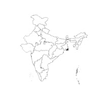
We all love some nice colored maps which can convey certain characteristics of the data. There are a lot of different libraries that provide in-built maps which can be rendered with one-liners. This post attempts to create maps or choropleths out of maps which can be created using the shapefiles available over the internet. The advantage clearly is that we can build any kind of map be it a country, state or region within a district or city. The dataset I'm experimenting with here is available at Kaggle . It is a dataset about the demographics of 500 top cities of India. It publishes details like Adult and child populations, Sex ratio, Literacy figures, and Graduate population figures in each of these cities. Through the course of this post, I'll explore the various functions and libraries of R that have been integrated together while telling some interesting facts about the dataset and Yes! all through the choropleths. What are choropleths and shapefiles anyway? Accord...